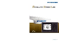
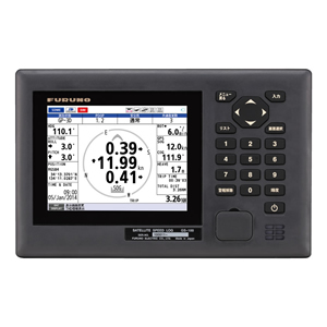
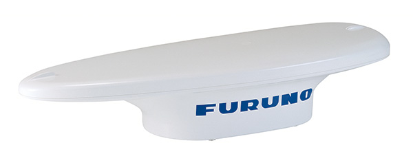
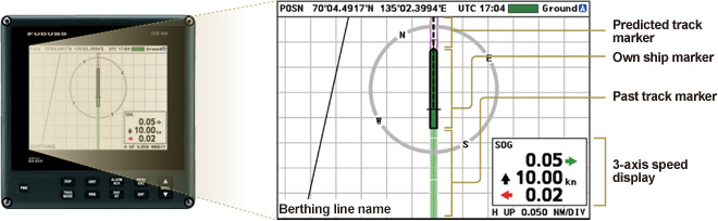
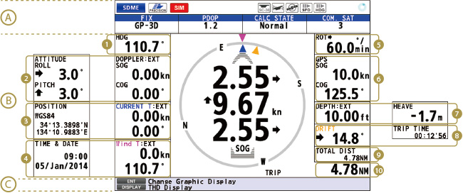
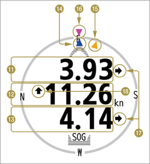
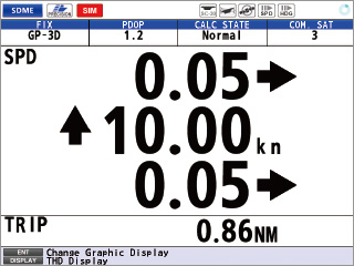
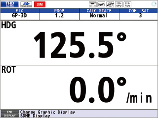
FURUNO satellite speed log GS-100 delivers highly accurate speed measurement for safe berthing and docking operations

Features

Offers transverse speed at bow and stern position, as well as longitudinal speed
Provides transverse speed at any position of the ship utilizing the built-in satellite compass
Delivers roll, pitch and angular information for navigation equipment such as Radar, ECDIS and AIS.

Accurate information of ship's attitude contributes to safe and efficient navigation.

Fully complies with SDME (Speed and Distance Measuring Device) standard (IEC 61023) and THD (Transmitting Heading Device) standard (ISO 22090-3)
5.7" color LCD
Compact antenna unit facilitates ease of installation
Simplified menu operation

The operator can navigate through the menu by pressing the cursor or pressing the numeric key associated with the menu items.

Speed accuracy ±0.02 kn

The measurement capability at dead slow speed is vital for precise docking of large ships.
The GS-100 offers speed accuracy of ±0.02 kn, which is of great help during berthing operations.
Also, an optional 8.4” color LCD for a wing workstation installation gives high-legibility, real-time information in both graphics and alphanumerics.

LCD
Optional 8.4" color LCD
(for wing installation)

Display Modes

Navigation Display

(Description will appear, when you put the mouse cursor onto each number.)


Navigation Display screenshots 1

(A) Current selected mode (SDME or THD), integrity status and common satellite number, etc. are displayed.

(B) This area shows the information specific to the display mode currently selected.
Please refer to each of the display modes for details.

(C) Guide to currently available actions is displayed.
Under an alert situation, the information about the most imminent alert is displayed.

(1)Heading

(2)Roll/Pitch or Doppler measured SOG/COG*
* displayed with connection of appropriate external sensors

(3)Position or Current speed/direction*
* displayed with connection of appropriate external sensors

(4)Time & Date or Wind speed/direction*
* displayed with connection of appropriate external sensors

(5)ROT

(6)GNSS measured SOG/COG

(7)Heave or Depth*
* displayed with connection of appropriate external sensors

(8)Trip time or Drift angle*
* displayed with connection of appropriate external sensors

(9)Total distance

(10)Trip distance


Navigation Display screenshots 2

(11)Transverse speed at bow position

(12)Longitudinal speed

(13)Transverse speed at stern

(14)Current direction*
* displayed with connection of appropriate external sensors

(15)Drift angle*
* displayed with connection of appropriate external sensors

(16)Wind angle*
* displayed with connection of appropriate external sensors

(17)Bow/Stern velocity ←→

(18)Heading velocity ↑↓


Text screen

Speed/Trip
Speed/Trip
Heading/ROT
Heading/ROT

Brochure Download


Contact

Locate a Distributor Contact a local distributor for further details.