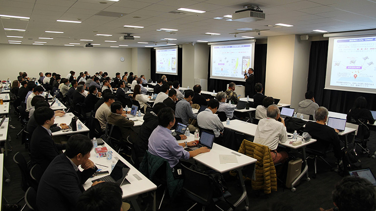
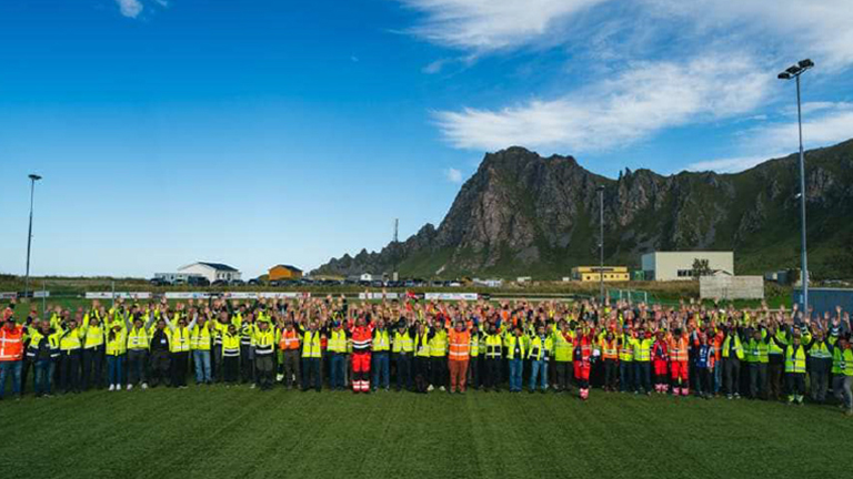
Report on "IIJ presents: GNSS Time Sync 2025" - FURUNO Field Report Vol. 01 -

Jan 25, 2024
Maps onto which theme-based information such as geological characteristics, vegetation, population distributions and so forth have been overlaid are known as "thematic maps." Such maps are often used in the classroom, and also in explanations on the news and in presentations. In addition to thematic maps, "thematic globes" also exist. These are three-dimensional projections of the earth's map along with thematic data onto a globe form.
I first learned about the concept of a thematic globe when the book WORLD PROCESSOR (Chikyu 56 no Kao, or "Fifty-Six Visages of the Earth," in the original Japanese) was published in 1990 by Shogakukan in Japan. The book is a collection of photographs by German-born artist Ingo Günther as part of his World Processor project.

WORLD PROCESSOR by Ingo Günther (Shogakukan, 1990). Photograph by this article's author.
Website: https://ingogunther.com/#/worldprocessor/
The fifty-six globe photographs have provocative titles such as "1990 Ozone Holes," "Refugee Outflows," "Military Budgets" and "Chernobyl Clouds." Themed data related to government, economics, society, the environment and so forth is carefully added to 30-centimeter-diameter earth photographs—in other words, at a scale of 1:42,000,000. Günther started this project in 1988, the year when "The Endangered Earth" was named "Planet of the Year" as "Person of the Year" by TIME Magazine. The next year, in 1989, the Berlin Wall fell, leading to the separation of republics from the Soviet Union as independent states, and to major redrawings of the world map during this transition to the post–Cold War era. It was no surprise that these journalistic art pieces that depicted various contemporary data using the earth globe as a canvas, gained widespread attention at that time. This project is still on going, and has depicted more than 1,000 global visages of the earth thus far.
Today, anyone can view the globe virtually, zooming it in and out at will through the Internet. There are many types of thematic globes available for viewing that utilize this same approach. GPSJam, which is discussed below, is one example of thematic globe data regarding our world in the here and now.
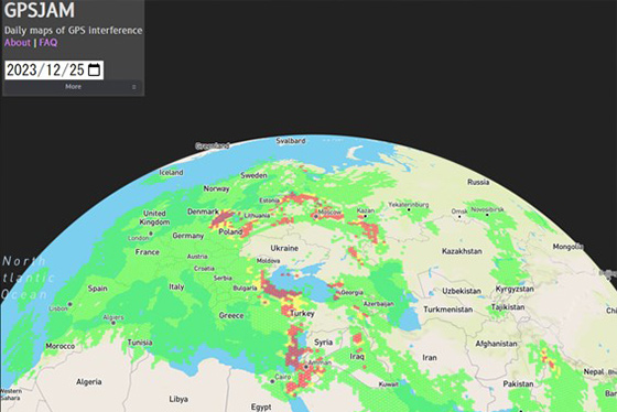
Source: John Wiseman, https://gpsjam.org/
Software engineer John Wiseman of Los Angeles, USA has created the "Daily maps of GPS interference" on GPSJam. As this labeling implies, the maps published here show day-to-day interference activities to GNSS on a global scale. Many forms of GPS interference exist; Wiseman's maps show instances of "jamming," which is achieved through large-scale output of interfering waves.
GPSJam divides the earth's surface into hexagonal cells roughly the size as Sado Island in Niigata Prefecture, Japan, (which is 855 square kilometers / 330 square miles in size), and color-codes each cell in one of three colors to indicate reduced GPS positioning precision. Information is updated once per day based on Coordinated Universal Time (UTC), and past data can be viewed as far back as February 14, 2022.
The system utilizes Automatic Dependent Surveillance–Broadcast (ADS-B) signals emitted by aircraft in order to estimate interference levels. These standard-based signals are broadcast by each aircraft individually to communicate information such as identification number, position and speed, which facilitates safer and more efficient aircraft operations. ADS-B signals can be received by anyone who has the proper equipment.
As a relatively familiar example to many readers, Flightradar24, ADS-B Exchange and AirNav RadarBox are some aircraft tracking websites that collect ADS-B signal data from all over the world and visualize them.
ADS-B signal data has a parameter called "integrity," which refers to the reliability and precision of its positioning information, and GPSJam utilizes this parameter as an index for estimating jamming levels and creating its maps.
Jamming, which is a primitive and heavy-handed method, targets broadcasters and other telecommunications services. When it comes to GNSS, however, a more devious approach exists: spoofing, which is a kind of "signal impersonation."
Generally speaking, information on GNSS signals, which is based on civil specifications, is open to public, meaning it is possible to generate fake GNSS signal which people expect to receive at a certain place and time. However, this is much more difficult than jamming, as positioning calculations in the receiver system use signals from multiple satellites. Therefore, spoofing can only be accomplished if the spoofer has sufficiently sophisticated software and computer and broadcasting equipment that enables to generate consistent signal with the real GNSS system.
Additionally, anti-spoofing measures are employed by signal receivers, algorithms that detects multiple frequencies and discrepancies are becoming more sophisticated, and research and deployment of directional antennas are progressing. Generally speaking, spoofers work almost the same way as GNSS signal simulators, utilized for development and assessment of receiver, meaning that the more sophisticated the simulators become, the greater the potential of anti-interference measures in receivers.
Wiseman is currently developing an algorithm for future implementation in GPSJam to estimate signal transmission sources for purposes of identifying spoofing occurrences (through means such as detection of sudden position hopping and so forth). However, he explains, "Unless there are more planes in the air, it will be impossible to find the interfering waves."
GPSJam's default start position is centered on Ukraine. The nation, which declared independence in 1991 under its yellow-and-blue flag, displays no green, yellow or red cells on the site's map; rather, there is a marked absence of data altogether. No ADS-B signal emitting planes are flying through Ukrainian airspace at the moment, meaning no data is available on which to base estimates. If one turns back the clock to around February 24, 2022 or so, when the conflict between Russia and Ukraine broke out, it's easy to see the process of data block disappearance as aircraft signals drop out.
As of the end of 2023, yellow and red cells indicating signal interference can be observed in the area extending from western Russia to the three Baltic states, in the region stretching from Turkey to Israel, near the India–Pakistan border, near the border between the United States and Mexico, and in certain other locations. It's easy to spot the problems with GNSS interference in Europe by viewing these maps.
Interference detection measures, which represent the first major countermeasures needed in such a situation, have already been deployed to a significant degree using existing equipment and on a global scale, which is quite impressive when you think about it. It's unlikely that red and yellow cells will all turn green again at the snap of a finger amid the ongoing crises in the abovementioned areas, and there is no telling when data-absent regions will receive coverage again. This thematic globe provide informations about warfare and conflict risk through GNSS signal interference. I hope this will be an indicator that shows where peace prevails and are kept as green areas. At least, that's my simple and somewhat sentimental view.

Born in Ishikawa Prefecture in 1964. Based on his experience in covering industrial technology, cutting-edge technology, and space development, he is passionate about unraveling and conveying difficult topics in an interesting way to people of all ages, from children to senior citizens. From 2009 to 2014, he was a member of the editorial board of "JAXA's," the official magazine of the Japan Aerospace Exploration Agency. Author and co-author of the following books: 『あなたにもミエル化? ~世間のなりたちを工学の視点から~』(幻冬舎mc)、『私たちの「はやぶさ」その時管制室で、彼らは何を思い、どう動いたか』(毎日新聞社)、『東京大学第二工学部70周年記念誌 工学の曙を支えた技術者達』(東京大学生産技術研究所) etc.,
_1.jpg)
_1.jpg)
_1.jpg)
_1.jpg)
_1.jpg)