The Observation Network Created by the Earthquake Proves Useful for Accurate Timekeeping (Part Two of Two) - A Solution to the "Mr. Higgins Problem" in Space -

May 22, 2025
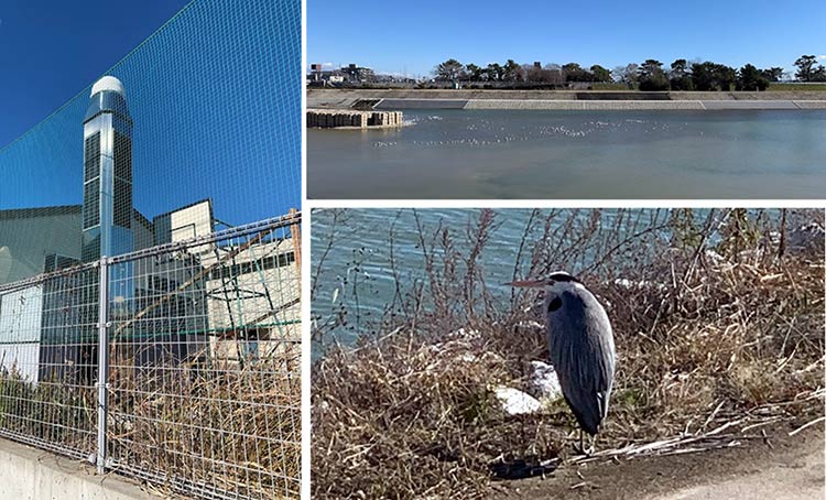
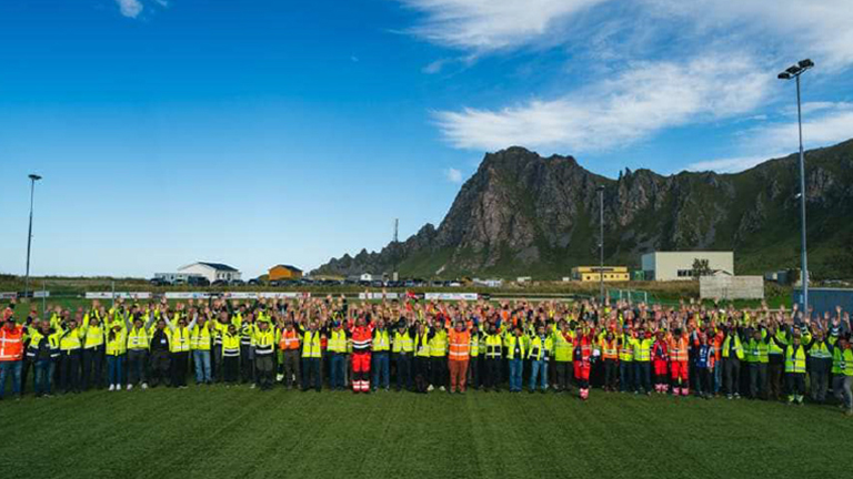
On a visit to Furuno Electric's headquarters in Nishinomiya City, Hyogo Prefecture, I took a slight detour to walk along the banks of the Mukogawa River. The river, which flows between Nishinomiya and Amagasaki down to Osaka Bay, offered a perfect walking course with groups of ducks leisurely floating on the water and thoughtful herons standing still. However, my purpose for the detour was not a stroll but a visit to the "electronic reference point" (electronic control point) located on an elementary school playground, just across the road from the riverbank.
(Photo) Electronic Reference Point "Nishinomiya" (950355), Komatsu Elementary School, Nishinomiya City
For those unfamiliar with the term, let me explain a bit about the "electronic reference point."
Though named a "point," its actual form is a reasonably large metal pillar, typically about 5 meters tall and built on public land, such as school grounds or gymnasium parking lots. The top is covered with a white plastic dome, housing a GNSS antenna. Inside the pillar are GNSS receivers, communication devices, batteries, and other electronic equipment, though these are not visible from the outside. The only indications of its existence are a commercial power line and the sound of a cooling fan in the summer. A utility pole connected to the power line has a panel marked "Geospatial Information Authority of Japan," identifying the equipment manager.
The Geospatial Information Authority of Japan has installed approximately 1,300 of these electronic reference points across the country. The term "electronic reference point" is derived from the electronic engineering method of receiving and analyzing positioning signals from satellites, similar to triangulation points and benchmarks used in maps and surveys. The more common term is "GNSS Continuous Observation Points," and in English, it is known as CORS (Continuous Observational Reference Station), emphasizing its status as a permanent observation facility.
In Japan, full-scale development of the electronic reference point network began in 1993 with a national budget allocation. In December of that year, the United States declared the start of initial GPS operations, having completed the deployment of 26 satellites in orbit. The concept of the electronic reference point, paired with pioneering positioning satellites like GPS, thus has a long-standing history.
In October 1994, the electronic reference point network began operating at 210 points nationwide. The network was divided into two systems with different purposes. Of the 210 points, 110 were concentrated in the South Kanto and Tokai regions to observe crustal movements, while the remaining 100 points were uniformly distributed nationwide at intervals of about 120 km for surveying purposes. An unforeseen opportunity to prove the robust and useful capabilities of these electronic reference points arrived soon after.
It was the Great Hanshin-Awaji Earthquake that occurred on January 17, 1995.
Electronic reference points have a unique feature that distinguishes them from other observation methods. By combining and analyzing data from two different electronic reference points, the relative positional changes between the two points can be determined with sub-centimeter precision. While this requires more observation data and computational power compared to positioning methods used by ships, automobiles, and smartphones, it achieves an accuracy that is literally orders of magnitude greater.
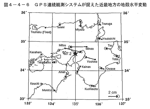
This figure shows the displacement of electronic reference points around the epicenter before and after the Great Hanshin-Awaji Earthquake. By fixing one distant point presumed to have minimal earthquake impact and determining the relative displacements with each point, the direction, magnitude, and extent of the crustal movement become evident.
For instance, in Mitsu, Hyogo Prefecture (approximately 46 km from the epicenter, hereinafter the same distance applies), the ground moved approximately 6 cm to the east. Meanwhile, in Minoh, Osaka (about 53 km), and Yoshino, Nara (about 80 km), it moved 4-6 cm to the west. Kainan, Wakayama (about 53 km), and Anan, Tokushima (about 82 km) also experienced impacts, both moving 1-2 cm south. As the explanatory text states:
"In conventional surveying, it took weeks to establish an observation plan, conduct the surveying work onsite, and produce the analysis results after an earthquake occurred. (Excerpt) The GPS continuous observation system not only expedited the time to produce analysis results but also made it possible to measure the ground movement caused by the earthquake with unprecedented high time resolution."
(Quotation: Prime Minister's Office "Hanshin-Awaji Earthquake Restoration Journal" Chapter 4① https://www.bousai.go.jp/kyoiku/kyokun/hanshin_awaji.html)
The results demonstrating the significant ground movement serve as "irrefutable evidence" of the immense significance of the dense distribution of electronic reference points.
Quotation: Prime Minister's Office "Hanshin-Awaji Earthquake Restoration Journal" Chapter 4①
https://www.bousai.go.jp/kyoiku/kyokun/hanshin_awaji.html
Furthermore, the Great Hanshin-Awaji Earthquake provided an opportunity for experts to recognize the importance of surveying standards. The restoration and reconstruction required extensive construction work, including civil engineering to prepare the land for building foundations. Surveying the land's shape and elevation is essential before civil engineering, necessitating reliable reference points for accurate coordinates. However, due to the seismic shifts, the coordinates of previously used triangulation points and benchmarks became uncertain. Therefore, eight temporary electronic reference points were established in the affected areas to serve as reliable new benchmarks. According to the documentation, "Using electronic reference points as known points allows GPS surveying to be conducted directly on new points (unknown points), significantly improving efficiency and reducing labor." The observation data from these eight temporary electronic reference points were distributed via computer communication and utilized in practical surveying.
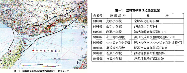
Quoted from "Geospatial Information Authority of Japan's Efforts in Response to the Great Hanshin-Awaji Earthquake"
https://www.gsi.go.jp/REPORT/JIHO/vol83-1.html
School facilities were often used as shelters immediately after the earthquake, and there were instances where "power outages due to breaker trips interrupted observation and data uploads."
The initially two networks were integrated into GEONET (GPS Earth Observation Network System), and its expansion has led to approximately 1,300 points being operational nationwide. Each electronic reference point is assigned a station number, with the first two digits representing the last two digits of the installation year. The "95" electronic reference points, initiated as a result of this earthquake, number 402 out of about 1,300, including "Nishinomiya" (950355), mentioned at the beginning of the article.
The 135°E meridian, which serves as Japan's time standard, runs through the area affected by the earthquake. A symbol of Japan’s timekeeping, the Akashi Municipal Planetarium’s tower clock, built on this meridian, opened on Time Day (June 10) in 1960. It’s well known that this tower clock stopped during the Great Hanshin-Awaji Earthquake, but it resumed operation upon the planetarium's reopening after three years of restoration work.
On January 17, 2025, marking exactly 30 years since the earthquake, the planetarium held an event where the tower clock was stopped at the earthquake’s onset time of 5:46 AM and restarted 12 hours later at 5:46 PM. The event aimed to "reflect on the progress of restoration and reconstruction and consider future disaster prevention."
Although natural disasters sometimes halt operations, it is always human effort that gets things moving again. Not only that, but people also strive to make operations more accurate. Electronic reference points—GNSS Continuous Observation Facilities (CORS)—which may seem unrelated to time accuracy at first glance, now play a crucial role in this context. The second part of this article will explain their connection and mechanism.

(Photo) From the Akashi Planetarium site
https://www.am12.jp/topics/202501170546/

Born in Ishikawa Prefecture in 1964. Based on his experience in covering industrial technology, cutting-edge technology, and space development, he is passionate about unraveling and conveying difficult topics in an interesting way to people of all ages, from children to senior citizens. From 2009 to 2014, he was a member of the editorial board of "JAXA's," the official magazine of the Japan Aerospace Exploration Agency. Author and co-author of the following books: 『あなたにもミエル化? ~世間のなりたちを工学の視点から~』(幻冬舎mc)、『私たちの「はやぶさ」その時管制室で、彼らは何を思い、どう動いたか』(毎日新聞社)、『東京大学第二工学部70周年記念誌 工学の曙を支えた技術者達』(東京大学生産技術研究所) etc.,
_1.jpg)
_1.jpg)
_1.jpg)
_1.jpg)
_1.jpg)