FURUNO 2019 "Your adventure begins!"
- GPS/Chart Plotter
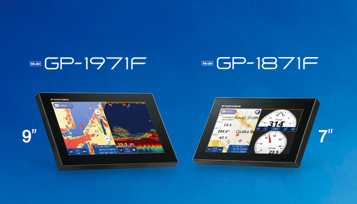
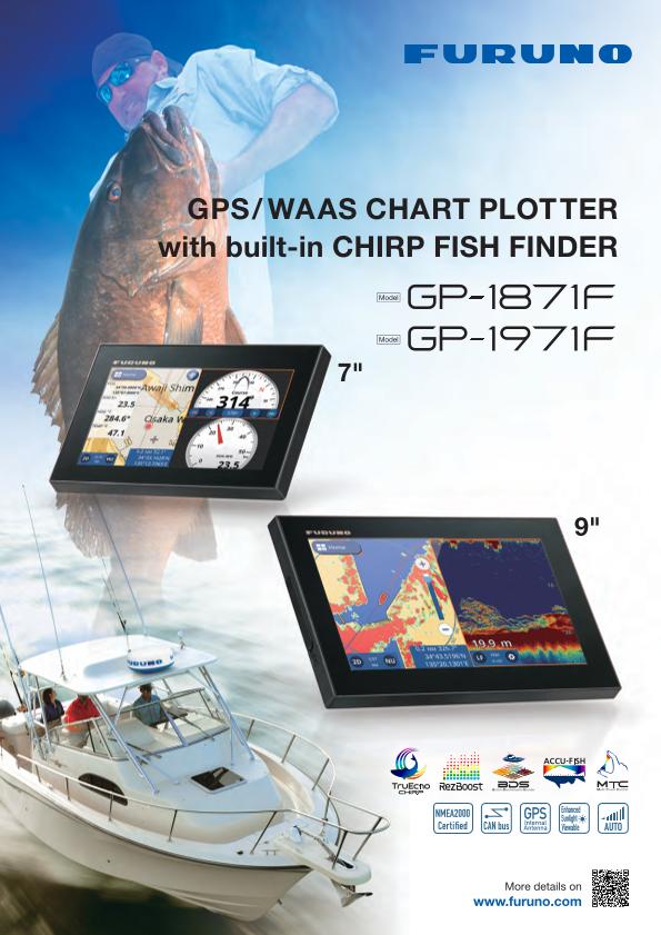
GPS/WAAS CHART PLOTTER with built-in CHIRP FISH FINDER
Model GP-1871F
7" GPS Chart Plotter/Fish Finder with Tablet Control/Mirroring function Available.
New Software Version 4.0
- Recreational Boats
Features
Chart Plotter (with internal GPS antenna)
Detailed Charts, Navionics and C-MAP 4D compatibility
By using the incredibly rich C-MAP 4D and Navionics charts, the GP-1871F/1971F delivers highly precise data that features plenty of useful information, such as relief vectors, tidal streams and marine plans, considerably enhancing your navigational awareness.
Compatibility with Navionics
The GP-1871F/1971F v4.0 is now compatible with Navionics+ and Platinum+ charts and offers various new features such as:
- Nautical Chart
- SonarChart™
- Community Edits
- Dock-to-dock Autorouting
- SonarChart™ Live
- Advanced Map Options
- Plotter Sync
More information on the Navionics Website (This link leads to an external website: Navionics)

Navionics Chart data
Compatibility with C-MAP
C-MAP Chart data

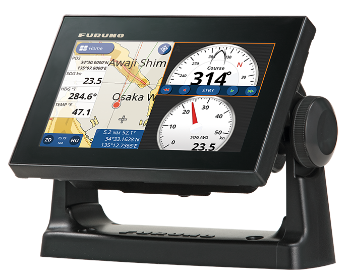
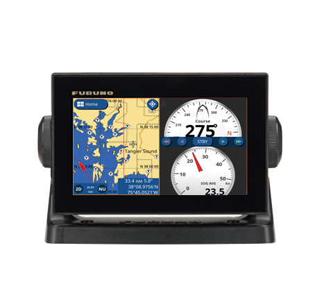
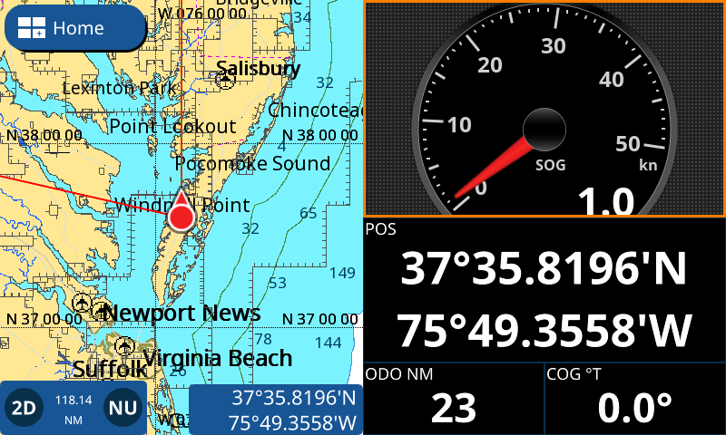
Chart Plotter with instruments panels
Autopilot controls
Chart Plotter with NAVpilot controls
Via the CAN bus network interface, The NAVpilot-300 and NAVpilot-711C can be connected to the GP-1871F and GP-1971F and controlled directly from the Chart Plotter.
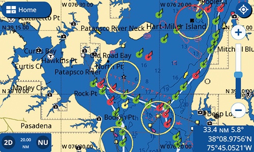
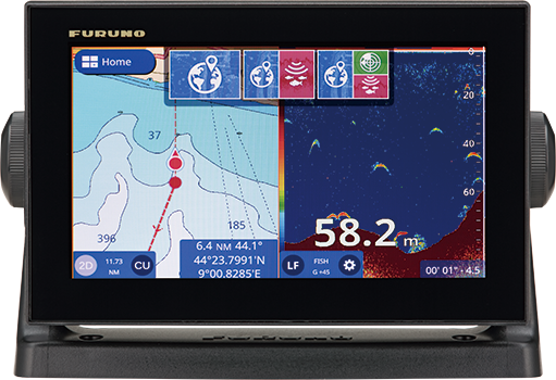
Plotter with AIS symbols
When connected to an AIS receiver, the GP-1871F/1971F will display the latest AIS data and provide vessel information.
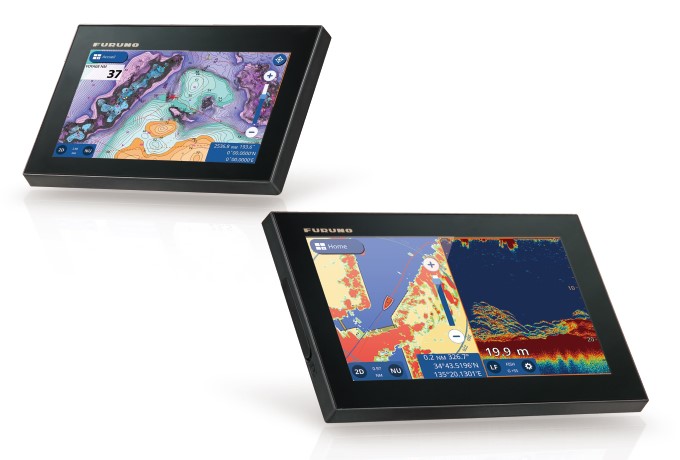
Various display modes
Including Shaded reliefs, 3D and Satellite views.
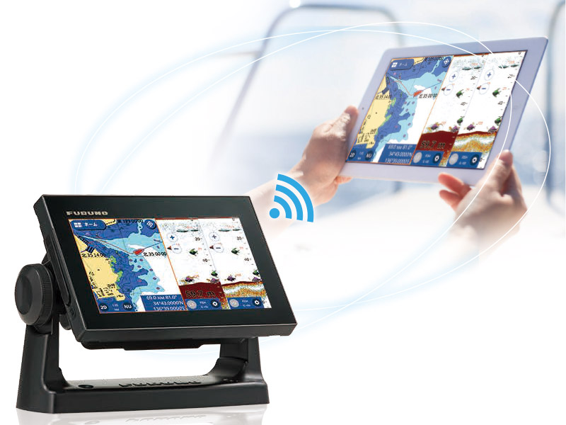
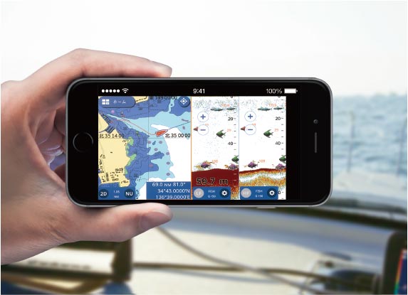
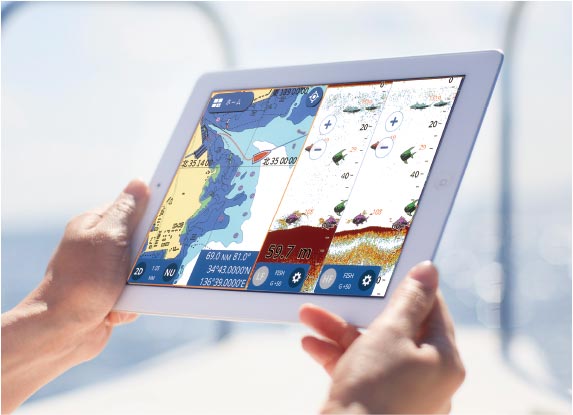
Wireless Connection to Smartphone and tablet
View your GP-1871F/1971F screen on your tablet or smartphone.
At any time, you can watch the sea conditions or use the GP-1871F/1971F's functions remotely from another location on the boat.
This function can only be used once the GP software has been updated
- The GP unit software version must be 3.0.4R or higher and a mirroring application is required.
Download the Mirroring application (freeware)


- Regarding the connection and the utilization of the application, please refer to the Operating Manual.
- You can use either the tethering or your preferred local network.
- The maximum number of connections is 1 per GP unit.
- The connection with the DRS4W and a smartphone cannot be made simultaneously
- The maximum distance of remote use is 5 meters. This distance can be reduced if objects are obstructing.
- Android OS version 9.0 and later is recommended for use of the app on Android devices
- Apple, Apple Logo, are trademarks of Apple Inc., registered in the U.S. and other countries
- App Store is a service mark of Apple Inc.
- Android and Google Play logo are trademarks, registered trademarks or service marks of their respective holders.
Multi-Touch Interface
Convenient and intuitive slide-out menus
The GP-1871F/1971F smart interface, inherited from the NavNet TZtouch2, features slide-out menus containing all the tools and data you need to be in total control.
Quick page
Layers
Data Box
Slide-out Menu
Display modes customization
Customize your display modes and create the perfect combination to fit your individual needs.

Customization menu
Main Menu and Display mode setting
Finger Gestures
With the Finger Gestures (one or two fingers) you can either zoom-in, zoom-out, double tap to take a screenshot or even jump to a full-screen mode when using Split-screen display mode.
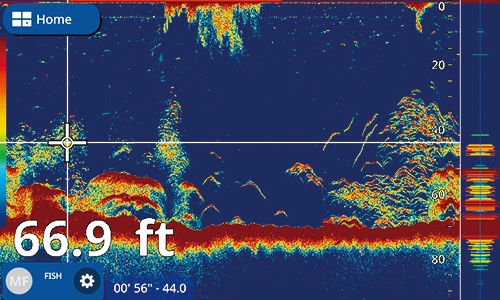
Built-in CHIRP FISH FINDER
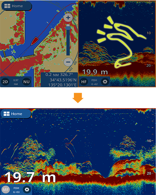
Unmatched detail with TruEcho CHIRP™

The high level of detail available with TruEcho CHIRP™ technology helps to distinguish fish schools, even when close to the sea bed.
Fish can be observed with a very high resolution and are displayed in a distinct boomerang shape. The clear presentation marks individual game fish and bait fish, even when tightly schooled together.
ACCU-FISH™ and Bottom Discrimination with RezBoost™
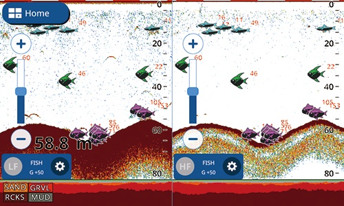
With FURUNO’s RezBoost™ data processing technology, fish schools and echoes are shown with high resolution while you can assess fish size and bottom composition thanks to ACCU-FISH™ and Bottom Discrimination functions.
Additionnaly, ACCU-FISH™ icons and colors can be freely customized according to the size and depth of the targeted fish.
The Ultimate Combo Units
Wireless Radar Connection
DRS4W 1st Watch Wireless Radar
The GP-1871F and GP-1971F are connectable to the 1st Watch Wireless Radar (Output Power 4 kW) giving your Chart Plotter a major upgrade in accuracy and safety.
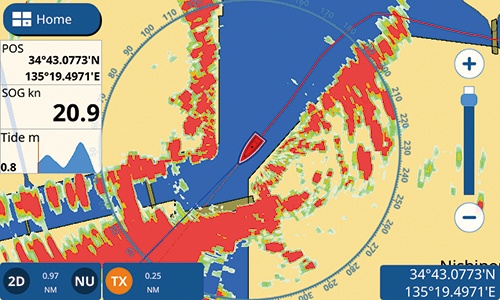
Plotter Overlay mode
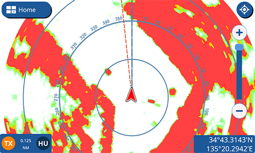
Radar mode
Easy screenshot and MicroSD card
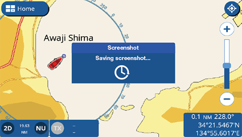
Tap the display with two fingers to capture a screenshot that will be saved directly to your microSD card.
AR (Anti-Reflective) glass coating and strengthened glass filter
Internal GPS antenna for simple and easy installation
Daylight viewable with excellent readability , brightness of 1000 cd/m2
Screenshots
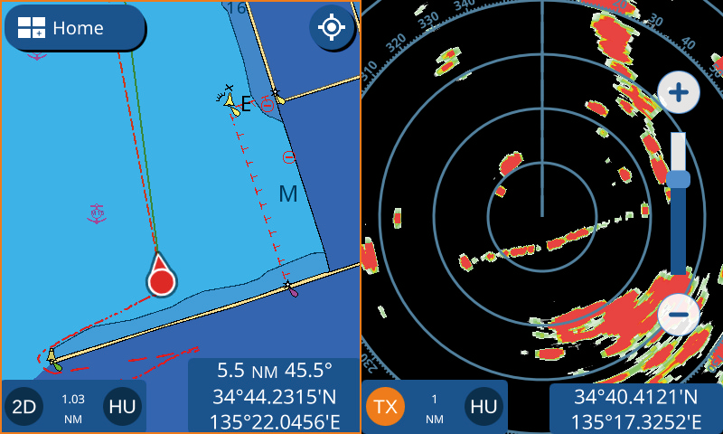
Dual Screen Chart Plotter / Radar

C-MAP4D Chart
Dual Screen Chart Plotter / Instruments
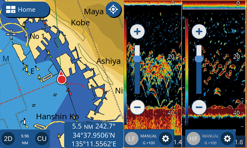
Dual Screen Chart Plotter / Dual Frequency FISH FINDER
CHIRP FISH FINDER
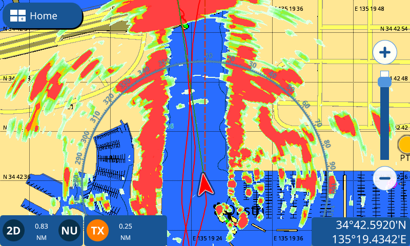
Chart Plotter Radar Overlay
Dual Screen Chart Plotter / Autopilot controls

CHIRP FISH FINDER + Quick Menu
Specifications
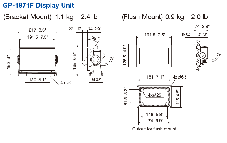
Display Unit
Display Unit
GP-1871F: 7" Wide Color TFT LCD
Screen Resolution
WVGA 800 x 480 pixels
GPS Antenna
Internal Antenna
Display Modes
Chart Plotter, Fish Finder, Radar (connection to the 1st Watch Wireless Radar DRS4W required), AIS (connection to AIS sensor required), Instruments (Nav Data, Engine, Wind, Fuel tank), Autopilot (connection to the FURUNO NAVpilot-300 or 700 series required)
Language
English (US & UK), French, Spanish, German, Italian, Portuguese, Danish, Swedish, Norwegian, Finnish, Greek, Japanese.
GPS / SBAS (WAAS/EGNOS/MSAS)
Receiving Frequency
GPS 72 channels
WAAS 1 channel
Receiving Type
L1 (1575.42 MHz)
Position Accuracy
GPS: 10 m Max, WAAS: 5 m Max, MSAS: 7.5 m Max
Plotter
Chart
C-MAP 4D and Navionics Charts
Memory Capacity
30,000 points for ship's track and waypoints
1,000 planned routes (Max. 250 points per route)
5,000 quickpoints
Fish Finder
Frequency
CHIRP: 40 to 225 kHz
CW: 50/200 kHz
Transducer
300 W or 600 W or 1 kW (Transducer dependent)
Range
5-1, 200 m, shift :0-500 m
Modes
TruEcho CHIRP™*¹, RezBoost™*², ACCU-FISH™*², Bottom Discrimination*², Dual Frequency*², Dual Range*² Auto gain (Fishing/Cruising), Manual gain, A-Scope, Marker Zoom, Bottom Zoom, Bottom Lock
*1 CHIRP dedicated transducer required
*2 Dual frequency CW compatible transducer required
Interface
NMEA 2000
1 port (Interface CAN bus)
Input: 126992, 127245, 127250, 127251, 127258, 127488, 127489, 127493, 127497, 127505, 128259, 128267, 128275, 129025, 129026, 129029, 129038, 129039, 129040, 129041, 129284, 129285, 129538, 129540, 129793, 129794, 129798, 129808, 129809, 129810, 130306, 130310, 130311, 130312, 130313, 130314, 130316, 130577, 130578, 130830, 130831, 130832, 130880
Output: 126992, 127245, 127250, 127251, 127257, 127258, 127505, 128259, 128267, 128275, 129025, 129026, 129029, 129033, 129283, 129284, 129285, 130306, 130310, 130312, 130316, 130830, 130831, 130832
NMEA 0183
1 port
Input: DBT, DPT, DSC, DSE, GGA, GLL, GNS, HDG, HDT, MTW, MWV, RMC, ROT, RSA, THS, TLL, VBW, VDM, VHW, VTG, ZDA, PFEC (GPatt/SDmrk/SDtbd/SDtfl/pireq)
Output: AAM, APB, BOD, BWR, DBT, DPT, GGA, GLL, GNS, GSA, GSV, GTD, HDG, HDT, MTW, MWV, RMB, RMC, RTE, THS, TLL, VHW, VTG, WPL, XTE, ZDA, PFEC (SDmrk/SDtbd/SDtfl/pidat)
Other
Micro SD Card Slot x 2 (32 GB)
Others
Waterproofing
IP56
Power Supply
GP-1871F: 12-24 VDC, 1.0-0.5 A
NMEA0183: 1 port * Software version 1.1 or later
NMEA2000: 1 port
Equipment List
Standard
GP-1871F
7"
Option
Transducer
525T-PWD
525T-BSD
526TID-HDD
SS60-SLTD/12
SS60-SLTD/20
525T-LTD/20
525T-LTD/12
520-PLD
50B-6 *10M*
50B-6B *15M*
200B-5S *10M*
50/200-1T *10M*
520-5PSD
520-5MSD
525-5PWD
525STID-MSD
525STID-PWD
Single Freq. CHIRP transducer
B75L, 300W
B75M, 600W
B75H, 600W
SS75L, 300W
SS75M, 600W
SS75H, 600W
TM150M, 300W
B150M, 300W
B175L, 1kW
B175M, 1kW
B175H, 1kW
B175HW, 1kW
Temperature Sensor
T-04MSB
T-04MTB
NMEA2000 Interface Unit
IF-NMEA2K2
Matching Box
MB-1100
Junction Box
FI-5002
Drawing
Downloads
| Name | Last update |
|---|---|
| Nov 5, 2025 | |
| Jan 18, 2022 |
| Name | Remarks |
|---|---|
|
|
Distributors of Marine Equipment
Contact a local distributor for further details.
- Specifications subject to change without notice.
GPS/Chart Plotter Product List
GPS/WAAS CHART PLOTTER with built-in CHIRP FISH FINDER
Model
GP-1971F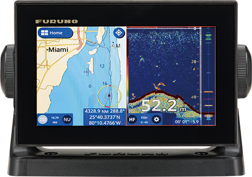
GPS/WAAS CHART PLOTTER with built-in CHIRP FISH FINDER
Model
GP-1871F
GPS/WAAS COLOR CHART PLOTTER with FISH FINDER
Model
GP-3700F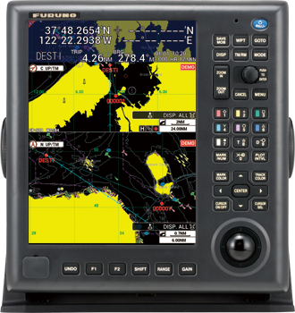
GPS/WAAS COLOR CHART PLOTTER
Model
GP-3700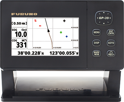
4.2" GPS NAVIGATOR
Model
GP-39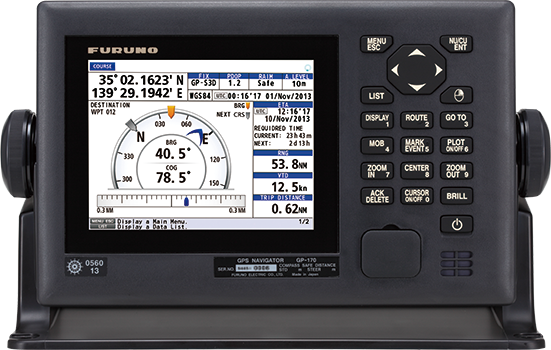
GNSS NAVIGATOR
Model
GP-170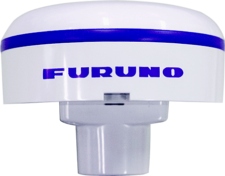
GNSS/SBAS Receiver
Model
GP340There are no products that meet the conditions.
Support
Support for Legacy Products
Downloads
Furuno Marine Sensor SDK
Service Provision Scheme
Quality Assurance
Locate a Distributor
Contact
Support for Legacy Products
Downloads
Furuno Marine Sensor SDK
Quality Assurance
Locate a Distributor
Contact
Support for Legacy Products
Downloads
Furuno Marine Sensor SDK
Warranty Policy
Quality Assurance
Locate a Distributor
Contact
Support for Legacy Products
Downloads
Furuno Marine Sensor SDK
Quality Assurance
Locate a Distributor
Contact
Support for Legacy Products
Downloads
Furuno Marine Sensor SDK
Quality Assurance
Locate a Distributor
Navigation
Communication
Other Marine Equipment
Monitoring Solution
Maritime Training