NavNet TZtouch Special Website
A powerful multifunction display designed for advanced navigation and fishing.
High precision and accurate heading of 0.25°rms
Perfect for Radar, ECDIS, AIS, Doppler Sonar and Autopilot
Provides highly accurate heading data for Autopilot, Radar, ARPA, Scanning Sonar, Current Indicator, Chart Plotter, ECDIS and Autopilot.
Ideal for medium to large vessels navigating in crowded ports and making precise maneuvers, such as berthing.
Ideal for small to medium boats requiring highly accurate heading.
Eliminating the problem of not having enough satellites at hand by using multiple types of satellites.
Twice the IMO high speed craft requirement, 20°/s.
Once the power is on, it takes about 90 seconds only to start
(The starting time will slightly differ depending on the equipment)
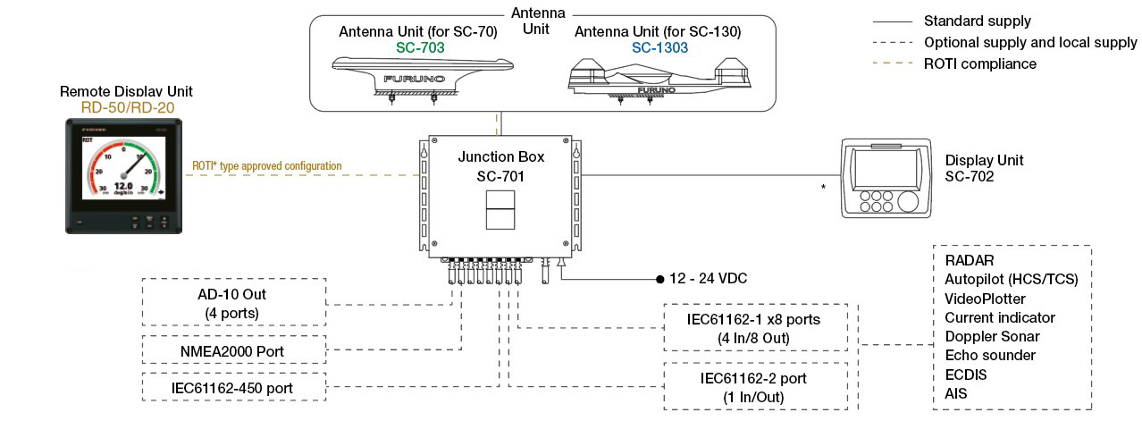
For SC-50/55/60/110/120 (The LAN_CNV option Kit is necessary)
4.3-inch color LCD, 95.04 (W) x 87.12 mm (H)
0.25
0.1°,0.01°,0.001° (select from menu)
45°/s
90 s approx. (typical)
GPS 5m approx. (2drms, HDOP<4)
DGPS 4m approx. (2drms, HDOP<4)
WAAS 4m approx. (2drms, HDOP<4)
MSAS 7m approx. (2drms, HDOP<4)
Number of ports (junction box)
IEC61162-2: 1 port (IN: 1,OUT: 1)
IEC61162-1: 8 ports (IN: 4,OUT: 8)
External beacon input (DATA5 port): RTCM SC-104 V2.3 (RS-485), ITU-R M823
NMEA2000: 1 port
AD-10: 4 ports, for heading output
RS-485 : 1 port, for display unit connection
LAN (IEC61162-450) :2 ports Ethernet 100Base-TX, RJ45 connecter
Antenna Unit : -25°C to +55°C (storage: -25°C to +70°C)
Display Unit/ Junction Box : -15°C +55°C
Antenna Unit : IP56
Display Unit : IP22 (IP35 : option)
Processor Unit : IP20 (IP22 : bulkhead mount)
12-24 VDC: 2.1-1.1 A (included Antenna Unit and Display Unit)
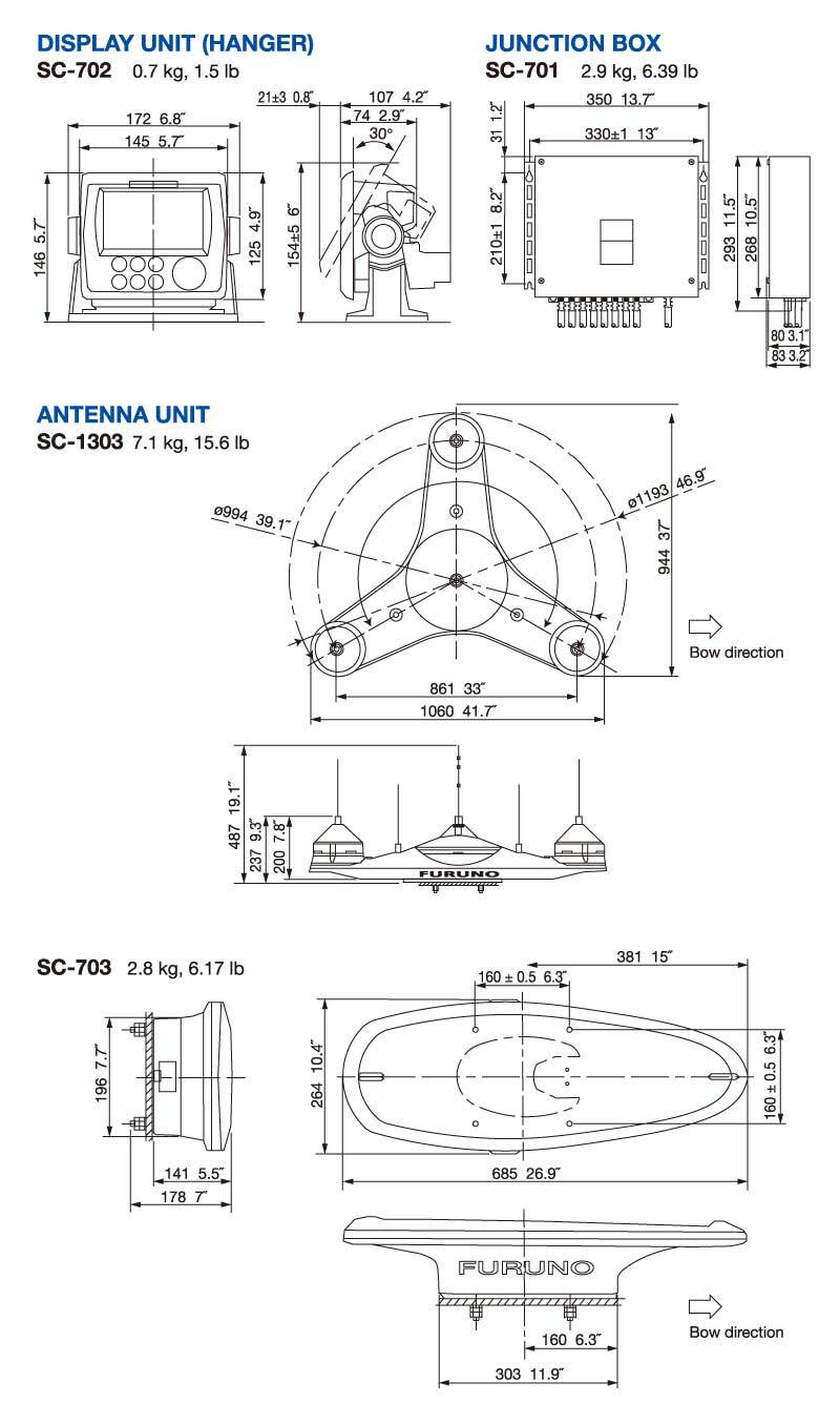
Display Unit : 0.7 kg
Junction Box : 2.9 kg
Antenna Unit (SC-1303) : 7.1 kg
PR-241
IF-2503/2550
IF-NMEA SC
RD-50/RD-20
FRU-RJ-PLUG-ASSY
MPS588-C
OP20-47/48
M12-05BFFM-010/020/060
LTWMC-05BFFT-SL8001
LTWMC-05BMMT-SL8001
SS-050505-FMF-TS001

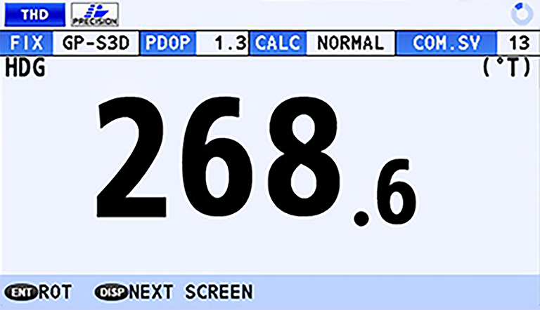
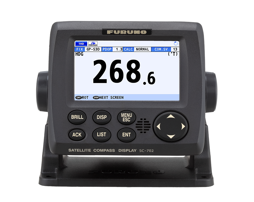
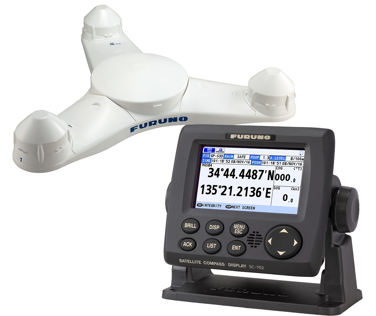
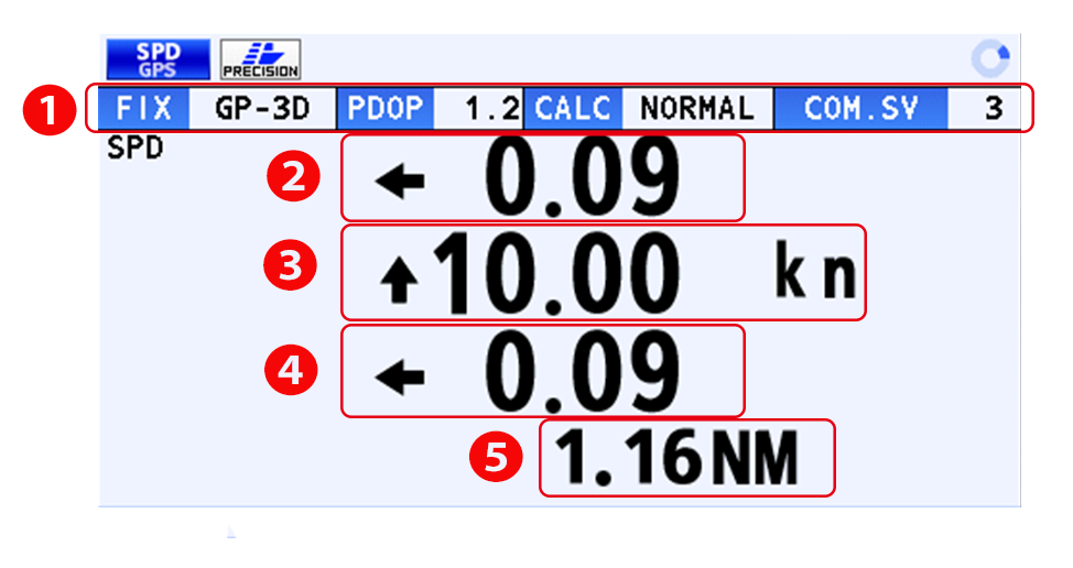
- Display the heading (HDG) of the ship
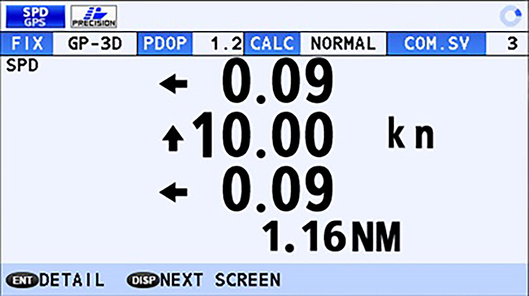
- 3-axis speed of the ship: Bow, Stern and longitudinal
(non-IMO type only)
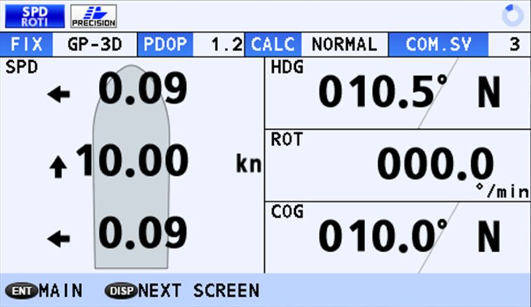
- 3-axis speed, as well as the Heading, Rate Of Turn and
Course Over Ground can be Grasped at a glance
(non-IMO type only)
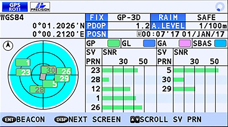
- GNSS (GPS,Galileo,GLONASS*) satellites signal reception
including signal strength and signal to noise Ratio
- SBAS signal status
*Type approved with GPS only
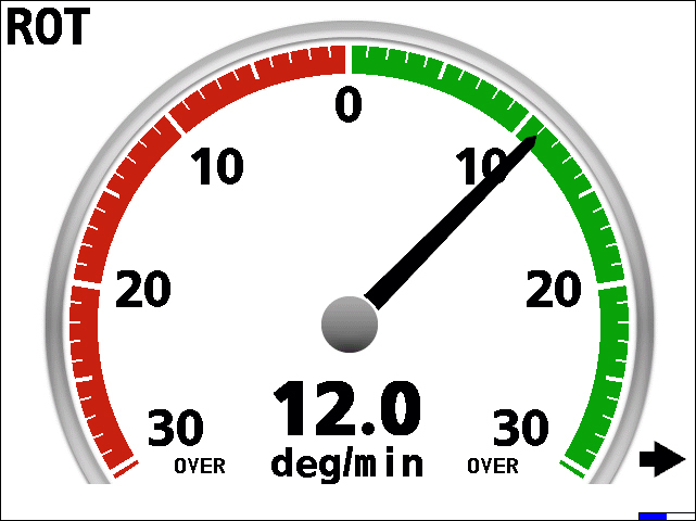
- Rate Of Turn Indicator displaying on the RD-50 (ROTI Display unit approved for SOLAS vessels)
| Name | Last update |
|---|---|
| Jul 1, 2026 |
Contact a local distributor for further details.

Model
SCX-20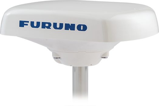
Model
SCX-21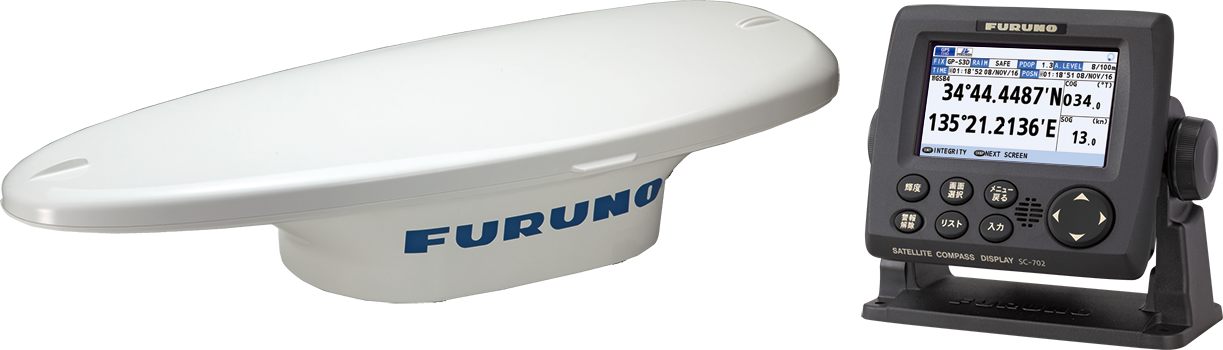
Model
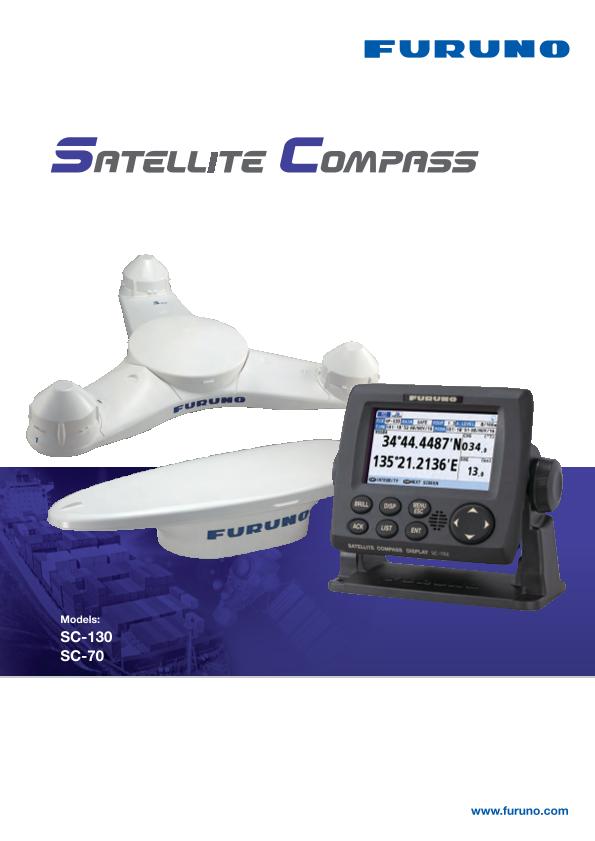
SC-70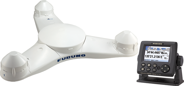
Model
SC-130
Model
SC-33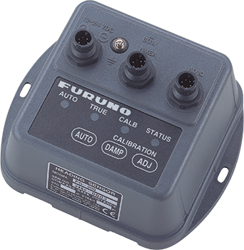
Model
PG-500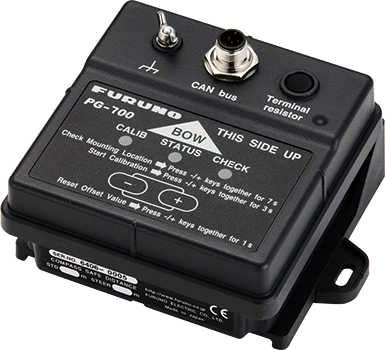
Model
PG-700