Echo analysis


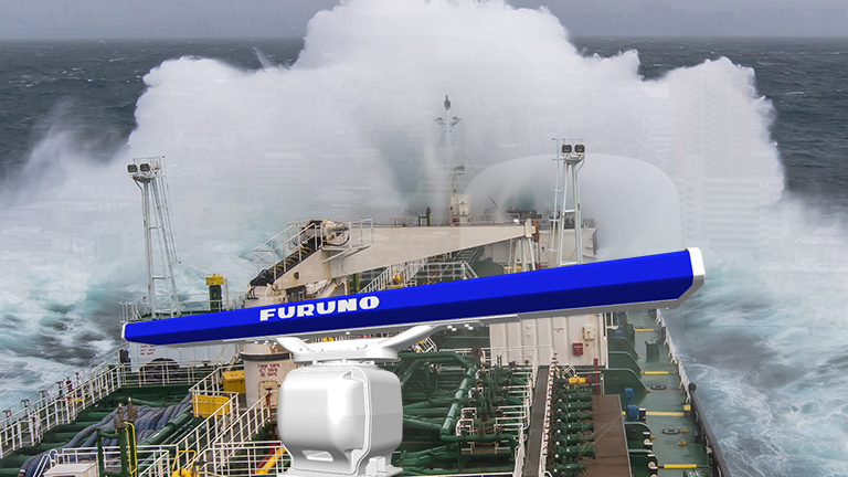
Radar Technology
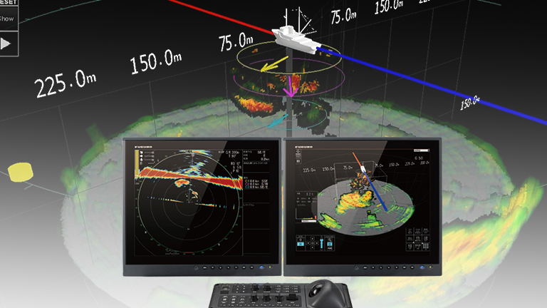
02 Technologies to analyze the movements of other ships
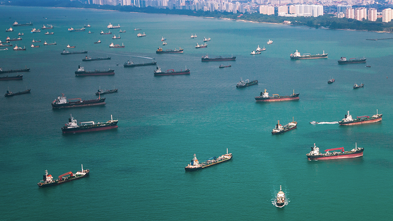
In crowded waters, where numerous vessels are densely gathered, it is necessary to monitor other vessels to detect any potential threat and prevent accidents.
But to differentiate these "dangerous targets" approaching your ship from other moving ships, you need to continuously monitor the radar and have the necessary experience to evaluate the situation.
Based on these facts, FURUNO has developed advanced technologies for the Radars that can reliably and intuitively track dangerous targets and, as a result, aid the users in their situational awareness.
Target Analyzer™
Dangerous targets can be immediately identified
Target Analyzer™
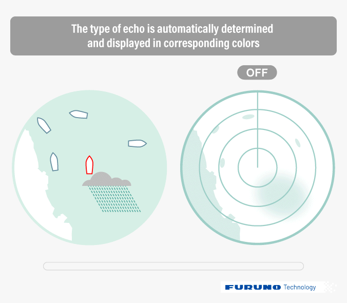
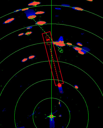
Display of color-coded echoes, dangerous ships are circled
Target Analyzer™ is an innovative technology that analyzes targets and identifies the dangerous ones that are likely to collide with your ship, using different colors according to the degree of danger. By displaying these dangerous targets in different colors, it becomes straightforward to understand and allows early detection of any threat to keep the navigation safe.
Available in both Magnetron and Solid-State Radar
FURUNO's Target Analyzer™ and its color-coded recognition function can be used with both Magnetron and Solid-State based Doppler Radars.
Doppler Analysis
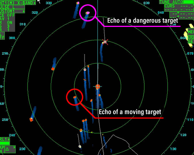
With the Target Analyzer™ function (Doppler analysis) incorporated into the DRS - NXT Radar series, it is possible to track hazardous targets in real time by determining their approaching course using the Doppler effect. Stationary targets are displayed in green, hazardous targets in red and when the "Rain mode" is on, rain echoes are shown in blue.
Echo Analysis
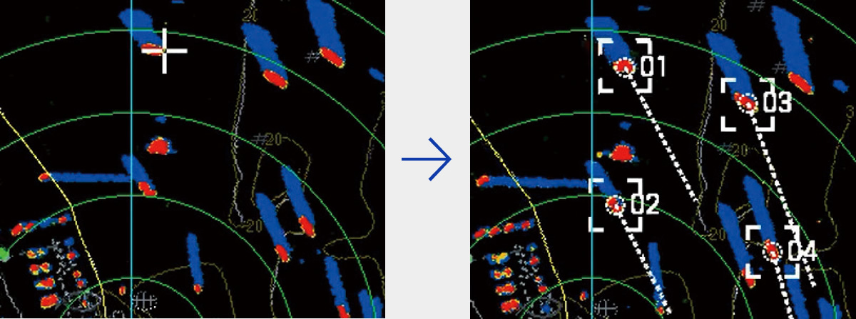
The Furuno Radars for professionals, FAR Series, and their built-in Target Analyzer™ need only a few scans to acquire a target and analyze its characteristics in order to determine whether the vessel will collide with the ship or not.
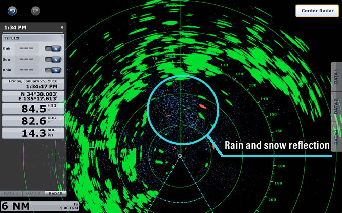
With the Echo analysis method, it is possible to acquire even more kinds of targets than with Doppler analysis. Not only moving targets, but also stationary targets, rain and snow will all be shown in different colors in addition to dangerous targets.
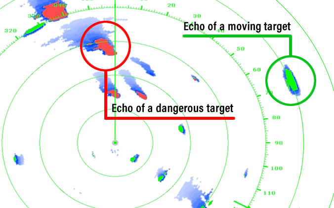
Furthermore, with the echo analysis method, even with a multitude of ships around the own vessel, only the targets presenting a collision risk, with their trajectory overlapping own ship's trajectory, will be considered as dangerous targets.
- Not available for Radars complying with SOLAS
- Depending on parameters, color codes of the echo analysis function may vary.
Target Analyzer™ comparison table
Doppler Analysis | Echo analysis | |
Compatible Radars | Solid-State Radar | Magnetron Radar |
Determinable target types | Dangerous (Risk of collision) | Dangerous (Risk of collision) |
Determination speed | Real-time Determination | Recognition based on multiple scans |
Echo analysis
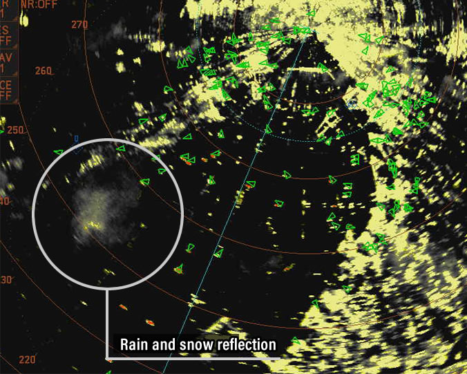
Image of rain and snow reflection with the Echo Analysis function
Doppler analysis
Rain mode with the Doppler analysis function
Introduction Video
POINT!
FURUNO Technology
Innovative technology to quickly track dangerous targets
Doppler Analysis with the capability to differentiate targets in real time
With even more targets that can be tracked at the same time, the Echo Analysis can be used with magnetron Radars as well

True Echo Trails
An intuitive way to display the movement of other vessels
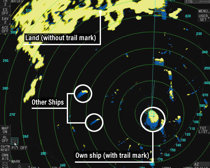
True Echo Trails
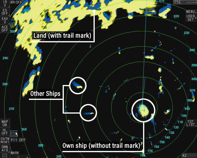
Displaying the trail of any echo
The echo trail is a technique used to visually understand movements (path and speed) of other vessels by displaying a residual image (trail) at different times of an echo.
For example, if a ship is navigating at high speed, long trails will be displayed. Conversely, trails will not be shown on stationary targets such as ships or buoys at berth. If a moving vessel stops, the trail will gradually become shorter.
Types of echo trails
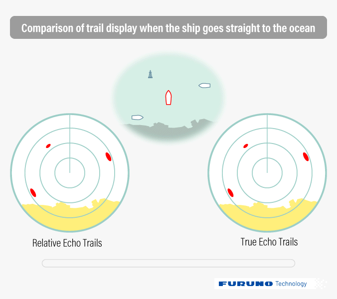
There are two distinct types of echo trails, true trail and relative trail.
With relative trail, the relative movement of other vessels based on your own ship's movement is displayed. On the other hand, with true trail, the true movement of the other ships, relative to the land and not your ship, is displayed. Therefore, there are no trails for stationary ships.
The true trail function is capable of seeing other ships' movement
True trail shows the trail of other ships on the Radar screen as if the viewer were looking down from a birds-eye view. It shows the actual speed of all vessels, which allows the user to grasp the movement of other ships more intuitively.
With FURUNO's true trail, you can also use the Head-Up mode.
- Appropriate sensors are required to use True Trails.
Relative trail
Trail based on own ship
True Trail
Trail mark relative to land and water surface
POINT!
FURUNO Technology
By displaying the residual image (trail) of an echo, the echo trail function helps your situational awareness of other ships' movement
The true trail function shows absolute movement of other ships
Head-Up Mode is available with Furuno true echo trail
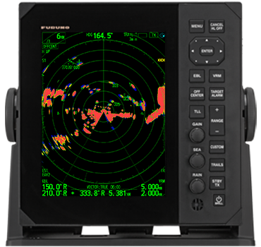
Products using these technologies
Fast Target Tracking™
Instant and stable tracking of other ships
Fast Target Tracking™
World's best target tracking
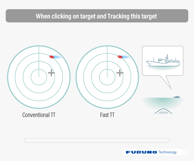
Fast Target Tracking™ (Fast TT) is a technology that instantaneously displays a vector indicating the speed and heading of the target.
Faster target acquisition
With conventional TT, it takes some time to display the velocity vector to predict the target's trajectory once it is selected. However, with the Fast TT, targets are automatically tracked right from the beginning, making it possible to immediately calculate the target's trajectory and display the velocity vector. This Fast TT function is particularly useful in congested waters as it can instantaneously track any target.
Evolution of acquisition stability and tracking performance
With its advanced algorithm, the Fast TT's tracking performance is significantly improved compared to any other conventional TT. In addition to suppressing the acquisition focus bug (acquisition mark jumping to a nearby target) caused by the presence of multiple targets, the Fast TT also offers high-level tracking performance of other vessels that make steep turns.
Once target is selected, a speed vector (course prediction result) is instantly displayed
Introduction Video
POINT!
FURUNO Technology
Acquiring a target instantaneously and displaying speed vector
Stable tracking preventing target transfer and instant response to sudden course change
Reliable technology to provide a quick grasp of other ship's trajectory even in congested waters
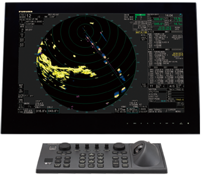
Products using these technologies
Risk Visualizer™
Preventing Collision Risks in Advance
The above animation is an example of the display on the FR-10/12.
Contributing to Collision Avoidance with Other Vessels
In congested sea areas where many vessels navigate, it is essential to constantly monitor other vessels' movements to avoid collisions.
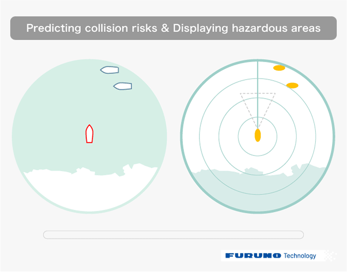
Risk Visualizer™ is a technology that displays hazardous areas where there is a potential risk of collision based on the positions and movements of your vessel and other vessels.
Visualizing Hazardous Areas
Assuming other vessels maintain their current course and speed, Risk Visualizer™ displays areas where there is a risk of collision if your vessel follows a certain course.
In case of a collision risk, it alerts the user with red indicators and warnings, helping to reduce human error and support situational awareness and navigation decisions.
Application in Evasion Navigation Technology
Risk Visualizer™ is expected to be applied in future evasion navigation technologies.
By utilizing AI and sensor technology to calculate collision risks with other vessels and obstacles in real-time, it can propose safe and efficient navigation routes to the operator.
Radar technology, which serves as the foundational information for suggesting evasion routes, will significantly contribute to enhancing the safety of future maritime traffic.
Examples of Target Display by Function
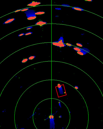
(1) Echo Trails Only
While you can know the past movements of other vessels and targets to watch, you cannot know future risks.
(2) Target Tracking + Echo Trails
Vectors show the course and position of targets after a set time, but you cannot know the positions where they will approach or collide.
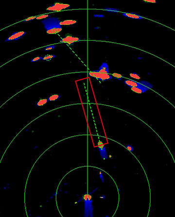
(3) Risk Visualizer™ + Target Tracking + Echo Trails
Risk Visualizer™ allows you to know not only the approach and collision risks on your current course but also the risks if your vessel changes course.
Introduction Video
POINT!
FURUNO Technology
Technology that displays hazardous areas with collision risks
Supports situational awareness and navigation decisions with red indicators and warnings
Expected to be applied in future evasion navigation technologies
Radar Technology
01
Technologies that clearly display what needs to be seen
02
Technologies that make the movement of other vessels easier to understand
03
Technologies that continuously deliver highly reliable images
04
Next-generation radar technologies and expanding solutions
Technology
Fish Finder
Sonar
Radar
GNSS (Timing, Automotive/Industrial)
Healthcare