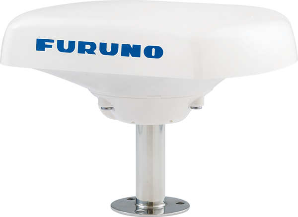
- Compass
Model SCX-21
Reliable accuracy in the most challenging situations
NMEA0183 Network Configuration
- Fishing Vessels、Workboats、Recreational Boats
Features
Quad-antenna design for extreme accuracy
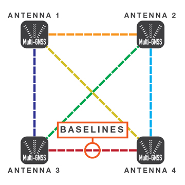
Utilizing four separate GNSS Antennas for the ultimate in responsiveness, the SCX-21 sets a new standard for reliable and accurate heading for all of your marine electronics. Traditionally, a Satellite Compass™ calculates heading using one baseline between two antennas; the SCX-21 four antennas can calculate heading information using any one of the six baselines drawn between the four antennas. The unprecedented quad-antenna design of the SCX-21 makes it capable of calculating extremely accurate heading, pitch, roll, and heave information. It is the perfect heading solution for complex vessel installations where the view of satellites may sometimes be obstructed.
Superior accuracy for all your sensors
The SCX-21 enhances the performance of on-board equipment such as Radar, Fish Finders, Sonar, and Autopilots. Accurate heading information empowers your NAVpilot to keep a better course, saving time, fuel, and money on every voyage; meanwhile, precise pitch, roll, and heave information stabilizes the display for many Furuno Fish Finders and Sonars, allowing for an accurate presentation even in the roughest of seas.
Radar Plotter
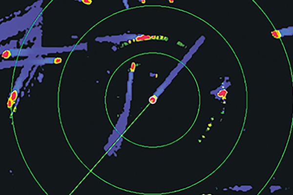
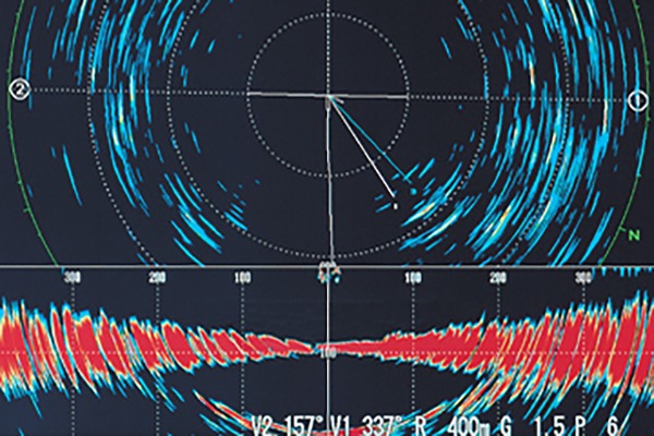
TRUE MOTION TARGET TRAILS
True echo trails are available when the SCX-21 is connected to your Furuno Radar, helping to determine own ship’s movement as well as the movement of other vessels. Accurate speed and heading data ensures that target trails are displayed smoothly and accurately, without the jagged, zig-zag appearance common to compasses with a higher degree of deviation.
Fish Finder
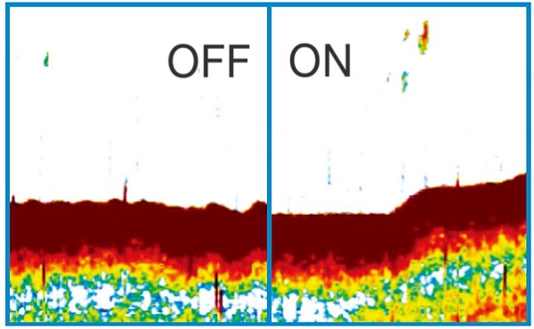
HEAVING COMPENSATION
Even in heavy seas, accurate heave compensation from SCX-21 enables Fish Finders such as the FCV-1150 or NavNet TZtouch/TZtouch2/TZtouch3 to show you an unwavering presentation of the seabed, without the undulations caused by sea conditions.
Sonar
PITCH & ROLL COMPENSATION
Accurate pitch and roll information allows Furuno Sonar systems to display a steady image on the screen, even in foul weather.
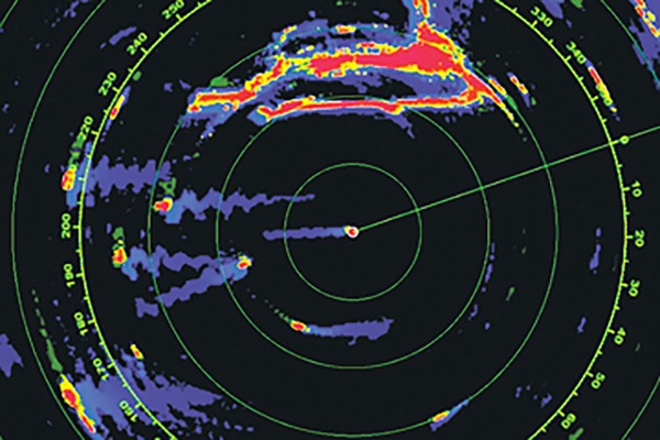
Radar Echo Trail ZIG-ZAG Domination
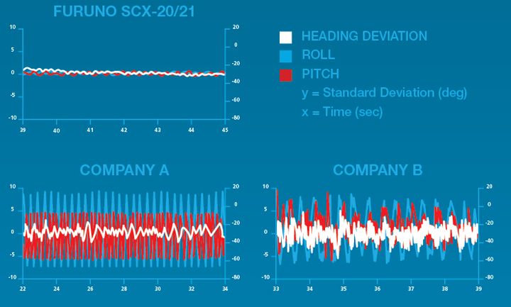
FURUNO SCX-20/21
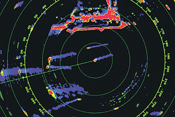
When connected to Furuno SCX-20/21, the Radar’s echo trails hold steady and clearly depict an accurate echo trail thanks to the SCX-20/21’s amazing accuracy.
Company A
Company A’s satellite compass fails to uphold a steady heading, making echo trails virtually unintelligible.
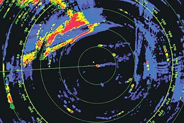
Company B
Company B’s heading accuracy fluctuates by +/- 3˚ with a slower update, causing an echo trail that has a wide zig-zag pattern.
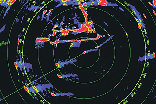
Company C
Company C’s heading accuracy fluctuates by +/- 5˚ with a faster update, causing an echo trail that is indistinguishable and confusing.

Relay Critical Data
Effortlessly connect with existing Furuno systems in order to elevate your awareness of own vessel and the surrounding area by displaying critical information across several products including NavNet TZtouch MFDs*, FI-70*, and GP-39! Initial setup can be done from GP-39.
- NMEA0183 - NMEA2000 converter required
- 3-Axis Speed
- Pitch, Roll, Heave
- Rate of Turn (RoT)
- Heading (HDG)

Perfect for NavNet TZtouch MFD*, NAVpilot-300*, and WASSP installations
- NMEA0183 - NMEA2000 converter required
Outputs accurate Time, Position, Heading, COG/SOG, ROT, Roll/Pitch/Heave 3-Axis Speed, Air Temperature and Air Pressure data
Unprecedented heading accuracy for Radars, Sonars, and Navigation
Utilizes four Multi GNSS (GPS, QZSS, GLONASS, Galileo) antennas
1.0 degree heading accuracy, 0.02 knot speed accuracy
Lightweight antenna - only 1.0kg!
A comparison that says it all
Roll - Amplitude 20°, 10 sec. period
Pitch - Amplitude 10°, 6 sec. period
Heading - 5°, 15 sec. period
Standard - ISO22090-3 (2015)
Specifications
General
1575.42 MHz (GPS/Galileo/QZSS/SBAS)
1602.5625 MHz (GLONASS)
C/A (GPS/QZSS/SBAS), E1B (Galileo), L1OF (GLONASS)
Heading/Roll/Pitch: 1.0° rms (static) 0.5° rms (dynamic)
45°/sec
60 seconds approx.
GPS: 5m approx. (2 drms, HDOP < 4)
MSAS: 4m approx. (2 drms, HDOP < 4)
WAAS: 3m approx. (2 drms, HDOP < 4)
3 Ports NMEA0183, Tx 3 Ch, Rx 2 Ch
1 Port PPS, RS-485, rising edge detecting
-25°C to +55°C (storage: -30°C to 70°C)
IP56
12-24 VDC: 0.2-0.1 A
Equipment List
Standard
FRU-CF-F cable (15m)
Pole Mount ONLY
Option
GP-39
Drawing

Interconnection Diagram

Downloads

Distributors of Marine Equipment
Contact a local distributor for further details.
- Specifications subject to change without notice.
Compass Product List
Model
SCX-20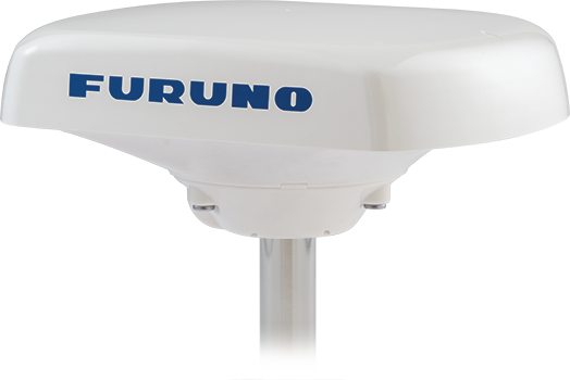
Model
SCX-21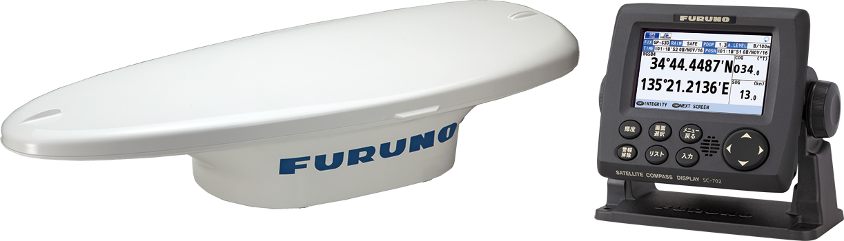
Model
SC-70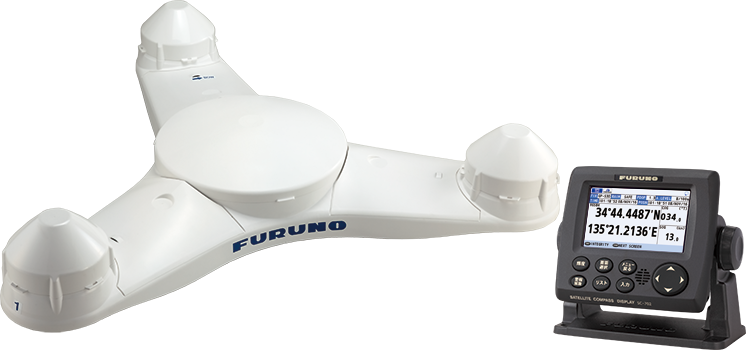
Model
SC-130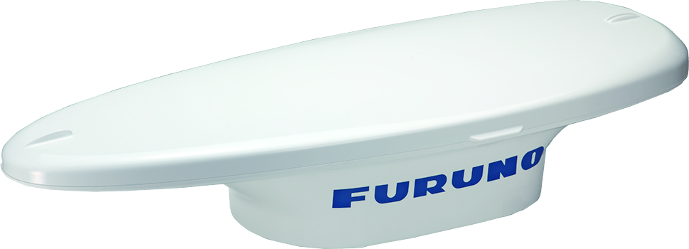
Model
SC-33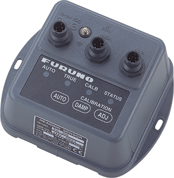
Model
PG-500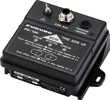
Model
PG-700